Collaborative research in the GLITTER network
My research within the Marie Sklodowska -Curie GLITTER network benefits from strong European partnerships that connect advanced satellite technology with important environmental challenges. Collaborations are important because they speed up the work and make it much easier to avoid mistakes from the outset. Working with others allows us to implement ideas more efficiently and to learn from different perspectives.
Collaboration with Dr. Estel Cardellach- Grazing Angle GNSS-R
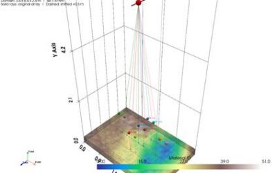
A central pillar of my work is the collaboration with Dr. Estel Cardellach at the Institute of Space Sciences (ICE-CSIC). Together, we explore the potential of Grazing Angle GNSS-R for precise monitoring of sea ice and ocean parameters.
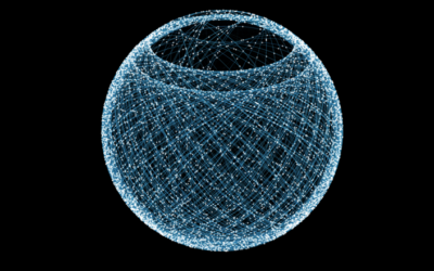
A special focus of our work is the development of an unconventional method, which is currently being tested. Using Archimedes’ principle, we aim to represent the physical properties of ice. I find this approach especially exciting because it allows us to gain some different insights that could be valuable for satellite observation of sea ice and ocean conditions -and in future for other observation environments (deserts, forests) or even for non-satellite experiments.
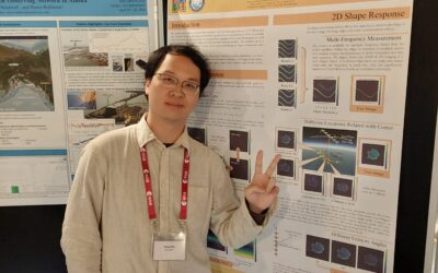
Signal Synchronization with Dr. Christophe Craeye
In collaboration with Dr. Christophe Craeye, we focus on the synchronization of GNSS-R signals. Our goal is to significantly improve signal synchronization for beamforming processes and, in a next step, extend this to array systems, which enhance the quality of the collected data.
My knowledge in embedded systems, precise time synchronization, parallelization and timestamping- skills I have also developed through my work in HPC prove to be particularly valuable in this context. Small details are often overlooked in the time synchronization of individual components, and I contribute to the team with my skills and my expertise on PCB design, such as matching trace lengths and managing oscillators. Synchronization and precise timestamping are key steps within the GLITTER- project for making reflected signals reliable and precise for environmental applications.
Humanitarian Applications with HydroScan
Beyond methodological and technical development, I am particularly committed to the practical impact of my research. In collaboration with HydroScan, we apply GNSS-R data to a concrete humanitarian case: flood monitoring in Vietnam.
A particular challenge in this context is the dense vegetation, and high rise buildings in the affected regions, which strongly influence GNSS-Reflections. I am especially excited about this challenge because it requires adapting the technology to really complex real-world conditions and developing solutions that can operate reliably in difficult environments.
Closing Thoughts
Being Part of a team has sped up our work and opened new perspectives for me (and I hope for them too). Of course, none of this would be possible without the University of Luxembourg.